What to Look for in an Aerial Photography Portfolio Before You Book in Dallas
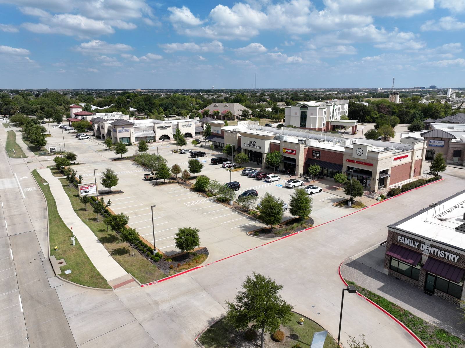
An aerial photography portfolio for real estate or commercial properties is simply a collection of images taken from above—usually by drone—that show where a property sits, how it connects to surrounding roads, and how the buildings or structures relate to the land around them. It’s not a gallery of pretty skies or artistic compositions. It’s a visual map. So what makes one useful instead of decorative?
Look for multiple altitudes, not just one view repeated
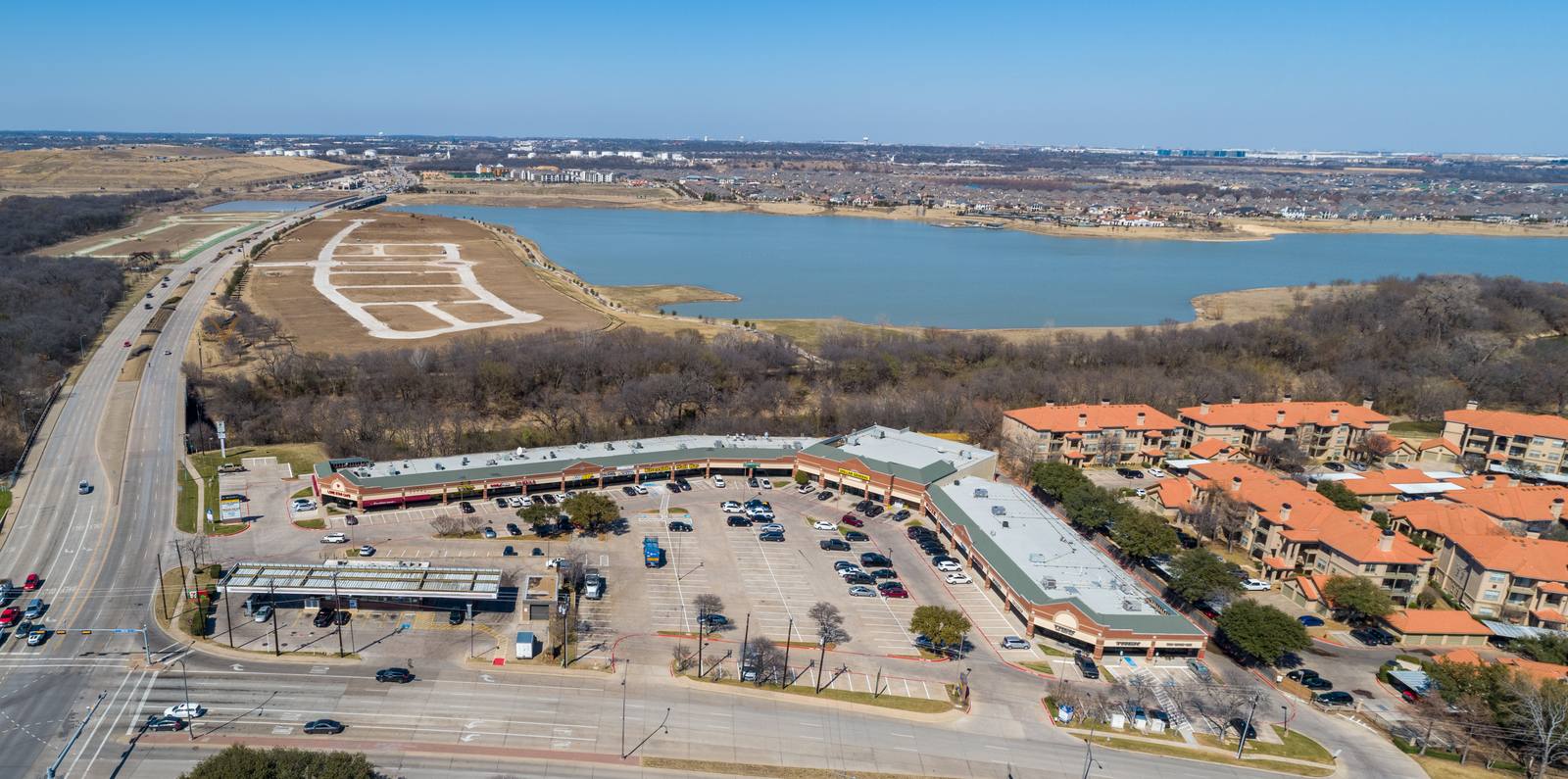
Too many portfolios show the same shot taken from the same height, rotated slightly. You’ll see the same roof angle, the same patch of grass, the same driveway entrance—just flipped left or right. That’s not a portfolio. That’s one frame with a spin. A real aerial set gives you three things: a high overview to show context, a mid-altitude shot to highlight the building’s footprint, and a lower pass that reveals the entrance, parking layout, or access points. I always shoot at least three distinct altitudes: 150 feet for the broad context, 75 feet for the building and immediate surroundings, and 40 feet or lower to capture driveways, signage, or entry lanes. If a photographer only offers one altitude, they’re not showing you how the property fits into its environment—they’re just showing you the roof.
Check if the sky is stealing the show
It’s March in Dallas. The grass is greening up, the trees are just starting to leaf out, and the wind’s picking up. That means clouds move fast, and blue skies are fleeting. A lot of photographers will wait for perfect blue skies, then shoot from 200 feet straight down, filling 80% of the frame with sky. That’s not helpful. That’s a postcard. What you need is a shot where the subject—your building, your property, your signage—dominates the composition. I’ll often adjust the drone’s angle to tilt down slightly, so the ground takes up 60% or more of the frame. I’ll even shoot in overcast light if it means the building isn’t lost in a sea of blue. You’ll see this in frame #0: the sky is there, but the parking lots, buildings, and highway are what you notice first. That’s the goal. A sky-heavy image might look nice on Instagram, but it doesn’t help a buyer understand where the property is or how to get there.
See if the shot shows how to get there
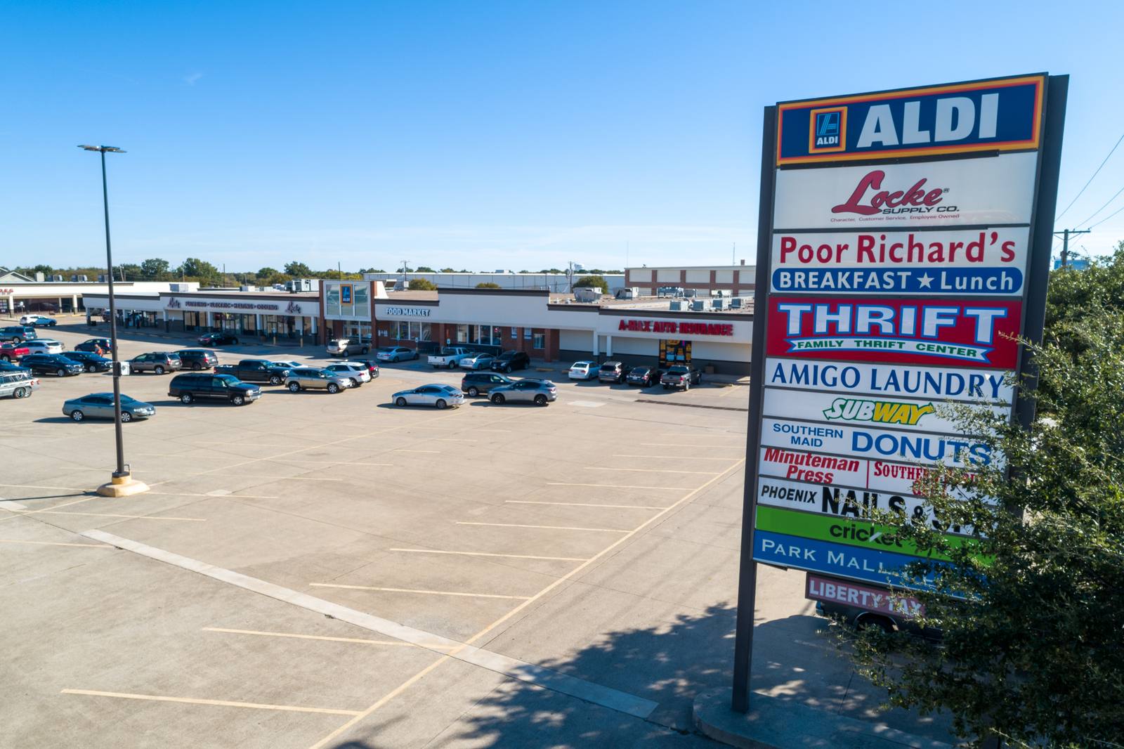
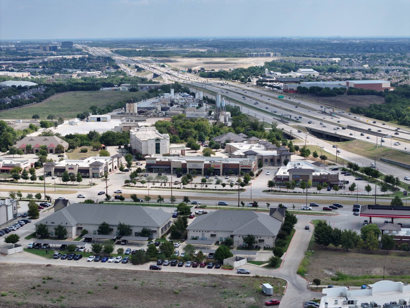
A property isn’t just a building. It’s a destination. You need to know how you get to it. Is there a main road? A side street? A hidden entrance? Is the driveway wide enough for trucks? Is there a turn lane? These aren’t details you can guess from a straight-down shot. The best aerial images show the relationship between the property and the road network. Look for frames where the driveway leads into the frame, or where the building is clearly adjacent to a highway or intersection. Frame #2 shows a highway flanked by commercial buildings—this isn’t just a pretty shot. It tells you the property is accessible from a major artery. Frame #4 shows a tall sign standing in a parking lot with storefronts behind it. That sign isn’t there for decoration—it’s a landmark. That’s what you want: context, not just coverage.
Watch for signs of rushed or unsafe work
There’s a reason the FAA requires commercial drone operators to be certified under 14 CFR Part 107. It’s not just paperwork. It’s about safety and control. If a portfolio has blurry motion trails, uneven horizons, or buildings that look stretched or warped, it’s a sign the pilot was flying too fast or too close to obstacles. In Dallas, wind speeds in March can hit 20 mph, especially around open parking lots or near the Trinity River corridor. A good pilot slows down, stabilizes the gimbal, and waits for the right moment—not rushes. I’ll often hold position for 10 to 15 seconds per shot to ensure the image is clean. If you see a lot of images with the same slight blur or shaky edge, walk away. The FAA doesn’t allow flying over people or moving vehicles unless you have a waiver, and even then, you have to be deliberate. A portfolio full of shaky shots suggests the operator doesn’t respect the rules—or the craft.
What you’re really paying for: the decision-making, not the drone
Here’s the thing most people don’t realize: the drone is the easiest part. The real skill is knowing what to shoot, when, and from where. In Dallas, a commercial plaza near the LBJ Freeway behaves differently than one near the Tollway. The light hits differently. The shadows fall differently. The traffic patterns change. A good aerial photographer doesn’t just fly a pre-set pattern. They look at the site and ask: Where do people approach from? What’s the most important feature to highlight? Is the signage visible from the road? Do I need to shoot this at 10 a.m. when the sun’s behind the building, or wait until 3 p.m. when the light hits the front? I’ll adjust altitude, angle, and timing on the fly. That’s not something you see in a portfolio. But you can see the result: images that make the property feel legible, not just visible.
Frequently asked
How long does an aerial shoot take?
In Dallas, a typical commercial property shoot takes 20 to 35 minutes on-site, depending on complexity. I don’t rush. I need time to adjust for wind, light, and access. The whole process—from landing to packing up—is usually under an hour.
Do you shoot interiors too?
No. Aerial photography shows what’s outside. If you need interior shots, those are done with a standard camera on the ground. I coordinate with photographers who specialize in that, but I don’t do both in the same trip. They’re different crafts.
What if it rains or winds up on my shoot day?
March in Dallas can turn fast. If the wind hits 25 mph or rain is in the forecast, we reschedule. It’s not just about image quality—it’s about safety and FAA compliance. I’ll call you the night before or early morning to confirm. No charge if we move it.
I shoot aerials in Dallas because that’s where the work is—and because I know how the light hits the parking lots at 10 a.m. in March, how the wind swirls around the Tollway overpasses, and how to make a building stand out without letting the sky steal the frame. If you need images that show where your property is, not just what it looks like, that’s the work I do. Find the full portfolio at flight1ap.com.
Ready to book your aerial photography session?
Get a Free Quote