How to Prep a Retail Plaza for Commercial Property Aerial Photography in Las Colinas
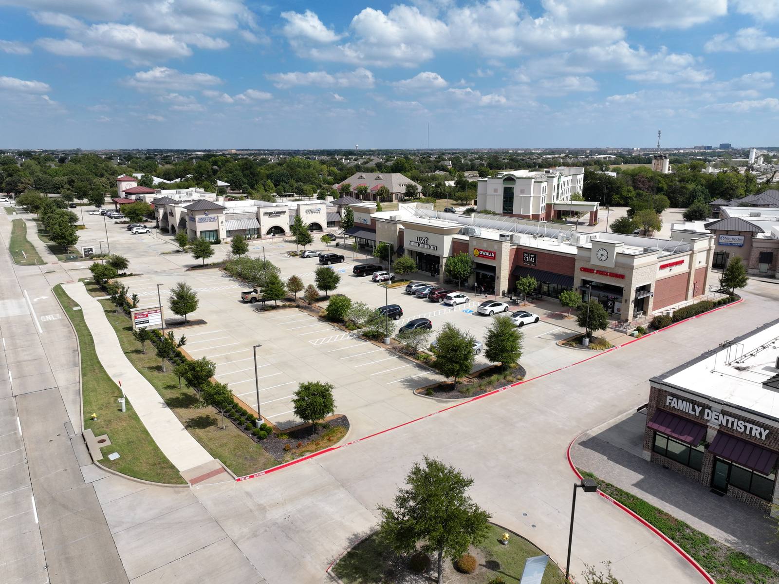
A commercial property aerial photography set is simply a series of overhead images taken from a drone that show how a building sits on its land, how people reach it, and what surrounds it. It’s not a marketing stunt. It’s a map with depth. So what makes one of these shots work — not just look nice, but actually help someone understand the place? It’s not the weather. It’s not the drone model. It’s what you’ve done on the ground before the pilot arrives.
What you’re seeing isn’t just a photo — it’s a snapshot of chaos
Most commercial properties in Las Colinas get shot between 9 a.m. and 1 p.m., when the sun is high and the light is flat. That’s fine for architecture, but it’s brutal for clarity. A drone shot from 200 feet up doesn’t care about your sign. It cares about clutter. If the trash enclosure behind your bank branch is overflowing with cardboard boxes and two broken carts, that’s what the camera sees. Not your brand. Not your awnings. Just mess. I’ve seen a full-frame shot of a strip center where the dominant visual element was a rusted dumpster leaning into a drainage ditch. The client didn’t know it was there until I showed them the file. That’s not your fault — it’s just what happens when you assume the aerial view won’t notice.
Start with the perimeter
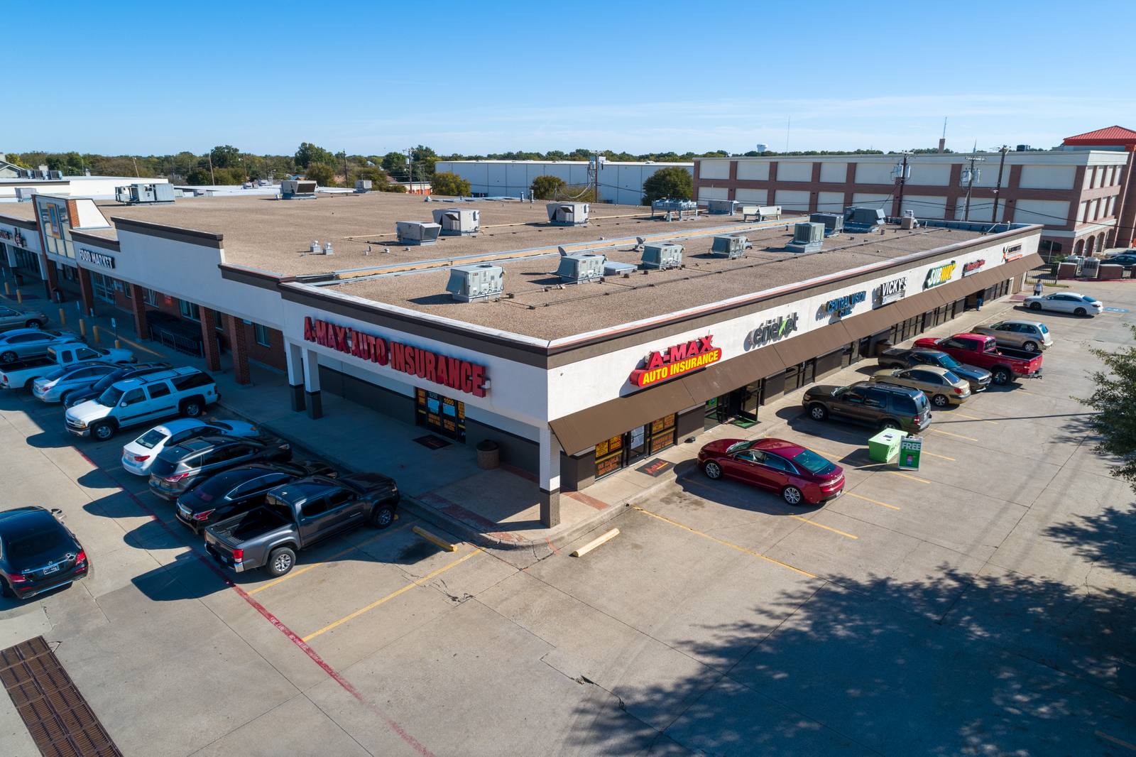
Before I even take off, I look at the lot from the street. The first thing I need to know is: where does the property begin? If the curb is cracked, the striping is faded, or there’s a chain-link fence that’s been pushed over by a delivery truck, that’s the edge of the frame. In Las Colinas, March wind kicks up dust, and loose gravel from parking lot repairs often ends up along the property line. If the edge of your lot looks like a construction zone, the whole image reads as neglected — even if the building is pristine. Walk the perimeter. Pick up any loose signage, move any parked carts or bins that aren’t meant to be there, and make sure the curb is clear. You don’t need to re-pave. Just remove the visual noise.
Move the trucks. All of them.
Delivery trucks are the #1 problem in commercial aerial shots. Not because they’re big — because they’re out of place. A FedEx van parked in the middle of the lot doesn’t say "active business." It says "I was here yesterday." In Las Colinas, March is the start of the rainy season. Trucks sit where they were last unloaded, and the mud from their tires gets tracked into the lot. If your building has a dedicated loading zone, make sure it’s the only one being used. Move every other truck — even if it’s just 50 feet away — to the farthest corner of the lot or into a side alley. I’ve shot the same plaza twice: once with four trucks scattered across the lot, and once with all of them parked in the northwest corner, out of the main frame. The second set showed a clean, open space. The first looked like a parking lot warzone. The difference wasn’t the drone. It was the truck.
Check the signage — not just the message, but the structure
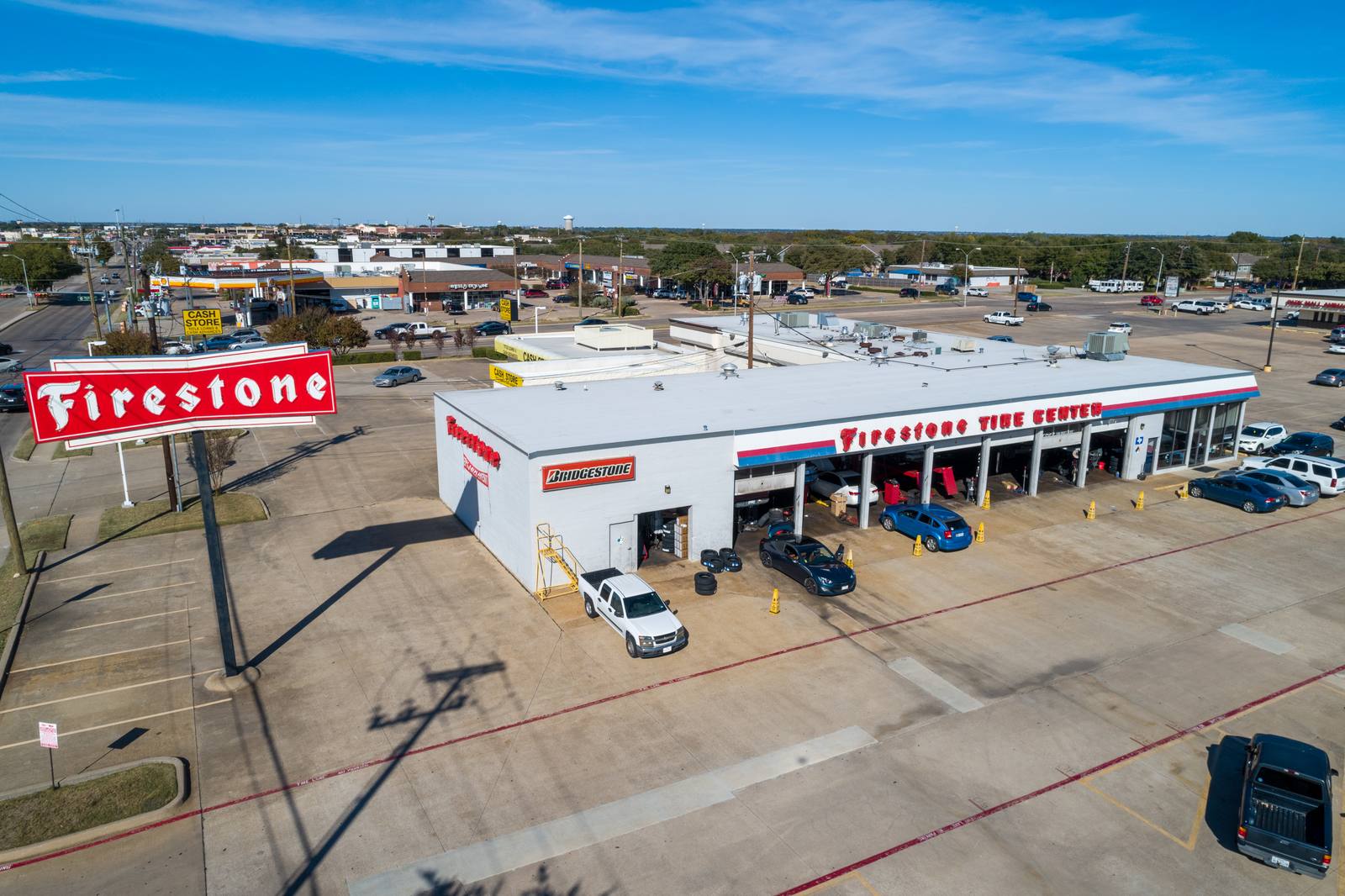
A sign that’s leaning, flickering, or half-covered in bird droppings doesn’t ruin the photo — it distracts from it. I’ve seen a sign with three faded logos on it: one still visible, two just ghost outlines. The drone doesn’t know you changed your business name last year. It just sees a broken visual. If you have multiple signs, make sure the primary one is clean, lit if it’s lit, and facing the main road. In Las Colinas, most commercial properties front Highway 114 or the Dallas North Tollway. The shot should start from the direction traffic approaches — usually the corner closest to the highway entrance. That’s where the frame needs to begin. I don’t shoot from the back. I don’t shoot from the side. I shoot from the approach. The viewer needs to understand how to get there before they notice what’s inside.
Trash enclosures and cart corrals are not optional
There’s a reason the FAA limits drone altitude to 400 feet (14 CFR Part 107). It’s not just safety — it’s clarity. At 200 feet, you can see the difference between a neat cart corral and a pile of bins spilled into the grass. If your trash enclosure is open, overflowing, or not enclosed at all, that’s what the photo shows. In Las Colinas, March is when landscaping crews start trimming hedges — and leave the clippings in the trash bin. That’s fine. But if the bin is full and the lid is off, the drone will see it. I’ve seen enclosures with three different brands of bins mixed together, some with lids, some without. It reads as disorganized. If you have a trash enclosure, close the lid. If you have carts, line them up. If you have a dumpster, make sure it’s not blocking the corner of the lot. That corner? It’s the first thing the frame includes. You don’t need to clean it. Just contain it.
What I do on site — the order, the light, the altitude
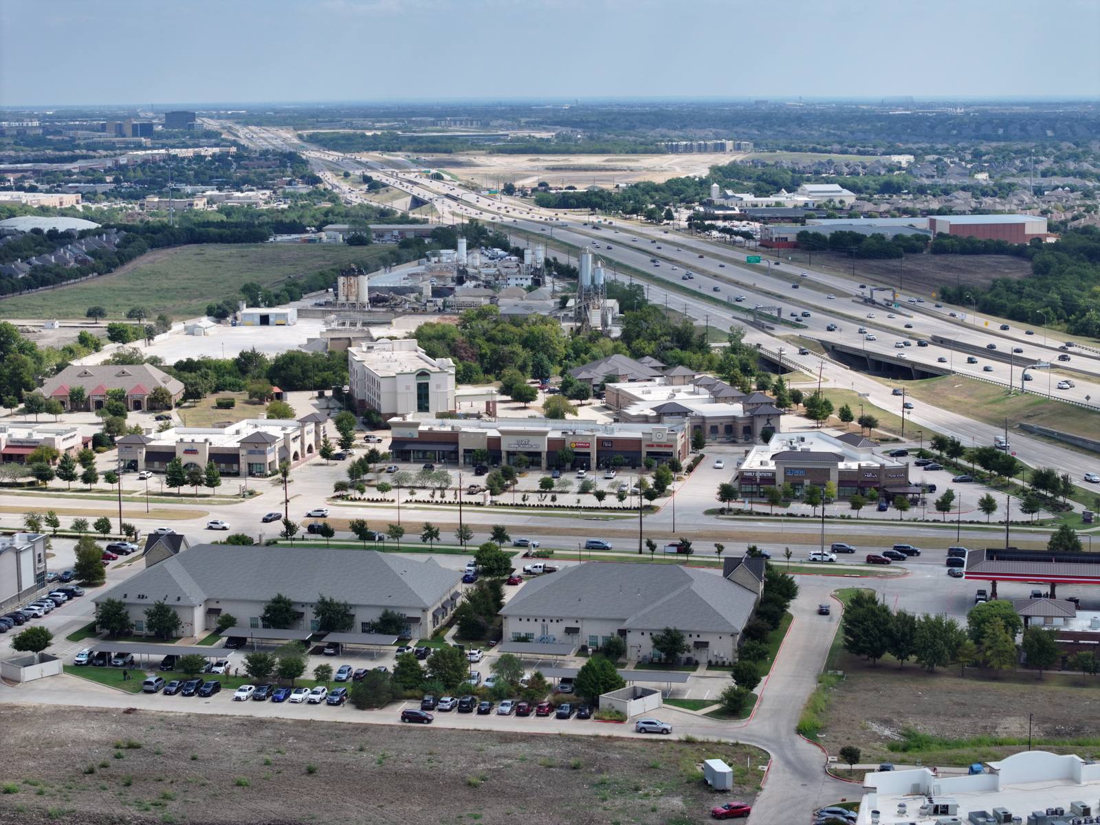
When I arrive, I don’t start flying. I walk the lot. I note where the sun hits the building at 10 a.m. — that’s when most shoots happen in March. The light is high, so shadows are short. That’s good. But if the building has glass, I watch for reflections. A drone at 150 feet with a 24mm lens captures a wide angle. At that height, the reflection of a parked car on a window can look like a second building. I adjust the angle, not the time. I shoot in sequence: first the wide shot from the approach corner, then a 45-degree angle to show the front facade, then a straight-down shot of the parking lot to show flow. I never shoot with the sun behind the building — it flattens everything. I never shoot when the wind hits 18 mph — that’s when the drone starts drifting, and the frame blurs. 14 CFR 107.51 says I can’t fly over people, but it doesn’t say I can’t wait. I wait for the lot to clear. That’s the craft.
Frequently asked
How long does the shoot take?
About 20 to 30 minutes, if the lot is prepped. If the trucks are still there or the trash bins are scattered, it can take twice as long — and I’ll need to come back. I don’t rush. I wait for the right light and the right space.
What do I get in the final delivery?
Five to eight fully edited images. Every photo is color-corrected, exposure-balanced, and cleaned of sensor dust or lens flare. No raw files unless you ask before we start. The edits aren’t filters — they’re adjustments so the building looks like it does in daylight, not washed out or overbright.
What if it rains or winds up the day of?
March in Las Colinas is unpredictable. If the wind hits 15 mph or there’s standing water from a storm, I cancel. I don’t shoot in rain. I don’t shoot in dust storms. I don’t shoot when the drone can’t hold position. I’ll reschedule at no extra cost — but I won’t deliver a shaky, blurry shot just to meet a deadline. That’s not professionalism. That’s a waste of your time.
I shoot commercial property aerial photography in Las Colinas — from strip centers to office parks — with the goal of showing what’s really there, not what’s hoped for. If you’re preparing your property, do the quiet work before I arrive. The rest is just flying.
Ready to book your aerial photography session?
Get a Free Quote