Industrial Property Aerial Photography in Fort Worth: What Matters Most for Warehouses
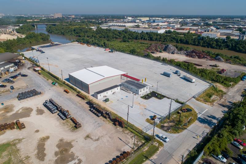
An industrial property aerial photography set is a series of frames shot from a few hundred feet that show where a warehouse sits, how trucks enter and exit, how many dock doors it has, and whether it’s close enough to a highway to matter. It’s not about making the building look impressive. It’s about answering the questions a logistics manager asks before they even step out of their car.
Why Fort Worth industrial brokers need this
In Fort Worth, a warehouse listing doesn’t sell because it has high ceilings or concrete floors. It sells because it has three drive-in doors on the south side, ten trailer spots out back, and a clear, unobstructed path to I-35. I’ve seen listings sit for months because the photos showed the building’s roofline and a pretty tree line—but didn’t show the access road that turns left at the fence line, or the fact that the nearest highway ramp is 0.8 miles away, not 0.3. That’s not a mistake. That’s a missed signal. Buyers aren’t looking for architecture. They’re looking for throughput. The aerial shot is their first map.
What the shot actually needs to show
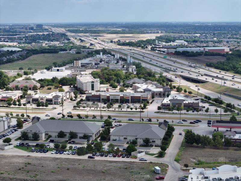
When I fly for an industrial property in Fort Worth, I don’t start with the building. I start with the highway. I fly out along the nearest major road—usually I-35, I-820, or State Highway 121—and then work backward. The first frame I take is from 400 to 500 feet up, angled so the highway runs diagonally across the bottom third of the image. That tells you instantly if the property is within a mile of a freeway exit. The second frame is a straight-down shot from 350 feet, centered on the building. That’s where you count the dock doors. You don’t guess. You count. Three? Four? Are they all on the same side? Are any recessed? Is there a drive-through lane behind them? If the answer isn’t clear in the photo, the buyer will assume the worst.
The third frame is the truck court. I drop to 250 feet and fly parallel to the rear of the building, keeping the trailer parking area in the lower half of the frame. I need to see the pavement condition—cracked? new?—and whether the parking spots are marked. Are they aligned with the dock doors? Are there any obstructions? A single light pole or storage container in the wrong spot can turn ten spaces into six. I also look for turn radius. Can a 53-foot trailer make the left out of the lot? Or does it need to do a three-point turn in a narrow driveway? That’s not something a floor plan shows. That’s something the drone sees.
Why a higher, straighter view beats a dramatic low angle
I’ve had brokers ask for a low-angle shot to make the building look bigger. I’ve seen it done elsewhere—in Plano, in Arlington, in Dallas—where the drone hovers at 50 feet, tilts up, and shoots the building from below, making the roof look like it’s leaning in. It looks cool. It’s wrong for industrial.
Industrial buyers don’t care how tall the building is. They care how many trailers fit in the yard. A dramatic low angle hides the pavement, cuts off the access road, and makes the dock doors look like they’re floating in the sky. At 350 to 450 feet, with the camera level, you get a clean, flat view. You see the entire footprint. You see the relationship between the building, the parking, and the road. You see the dirt lot where the scrap metal is stored. You see the chain-link fence that separates the property from the railroad tracks. That’s the information that matters. I’ve had warehouse buyers say, ‘I could tell from the photo if we could park 15 trailers or if we’d need to lease off-site.’ That’s not magic. That’s geometry.
I don’t use wide-angle lenses to ‘expand’ the space. I use a 24mm equivalent. That’s the sweet spot. Anything wider distorts the pavement lines and makes the parking lot look smaller than it is. Anything longer loses the context. I shoot at f/5.6, ISO 200, 1/1000s. That’s not creative. That’s accurate. The FAA limits drone altitude to 400 feet above ground level under 14 CFR 107.51. I stay at 350 to 450 feet to keep the whole property in frame without losing detail. That’s not a suggestion. That’s the rule.
What goes wrong—and how I fix it
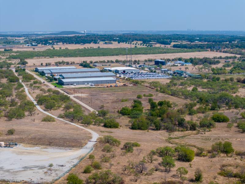
Most common mistake? Shooting on a hazy day. Fort Worth gets that late winter haze—thin, gray, flat light. It kills contrast. A dock door that’s supposed to look like three separate bays turns into one blurry rectangle. I check the visibility forecast before I fly. If it’s under 7 miles, I reschedule. I’d rather wait two days than deliver a photo that hides the most important feature.
Another one: shooting at noon. The sun is straight up. Shadows vanish. Pavement looks flat. You can’t tell if the lot slopes toward the building or away from it. I prefer late morning or early afternoon, when the sun is at 45 degrees. That’s when shadows are long enough to show texture, but not so long they swallow the parking area. In winter, that’s 10:30 a.m. to 1:30 p.m. In summer, it’s 11 a.m. to 2 p.m. I never shoot after 3 p.m. in Fort Worth. The light turns too warm, and the colors of the pavement and dock doors shift. Buyers compare photos. If one looks orange and another looks gray, they assume the property is inconsistent.
I also never shoot over trees. I’ve seen other drone operators fly over a wooded lot and claim the warehouse is ‘set back from the road.’ But the trees are 30 feet tall and block the view of the access gate. I fly around them. I get the view from the road, even if it means an extra flight path. If the buyer can’t see how they enter the property, they won’t buy.
The one thing you can do right now
You don’t need a drone to check if your listing’s aerial view is working. Go to Google Maps. Switch to satellite view. Zoom out until you can see the nearest highway. Then zoom in on the property. Ask yourself: Can I count the dock doors? Can I see the trailer parking? Is the access road visible? If you can’t answer yes to all three, your current photos are missing the point. Take a screenshot. Show it to your broker. Ask if they’d list it like this. If they hesitate, you already know what to fix.
Frequently asked
How long does the shoot take?
In Fort Worth, most industrial properties take 45 to 60 minutes in the air. I need to cover the building, the parking, the access roads, and the highway connection. If the property is over 10 acres, it takes longer. I don’t rush. I fly each angle twice—once to confirm, once to capture.
What do I get when it’s done?
You get six to eight fully edited, high-resolution aerial images, all color-corrected and sharpened for web use. I don’t deliver raw files unless it’s requested before the shoot. The edits include removing drone shadows, balancing sky and ground exposure, and enhancing pavement contrast so the parking lines are clear. No stylization. Just clarity.
What if the weather turns?
FAA rules under 14 CFR Part 107 prohibit flight in precipitation or winds above 15 mph. I don’t risk it. I’ve had clients ask me to fly in light drizzle. I’ve also had them thank me later when the photos didn’t look like a watercolor painting.
Ready to book your aerial photography session?
Get a Free Quote